
Singapore’s challenge is physical as much as it is economic. One source describes the country’s total area as 736 square kilometers, with limited room to expand sideways because it is bounded by the South China Sea, the Strait of Malacca, and Malaysia. It also notes that over the last 60 years Singapore reclaimed 150 km² of sea, expanding the island by 25% since independence in 1965, but that reclaimable territory is largely exhausted. That is why the current strategy increasingly looks down. One account frames the objective in clear terms: shift what does not need to be on the surface—such as oil-related infrastructure, ammunition depots, and sewage systems—into excavated underground spaces to free up land above for daily life.
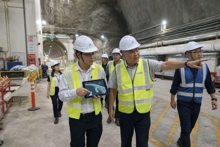
The scale described in the underground ambition is not small. A 2026 report says Singapore is building caves excavated about 150 meters deep, and that relocating oil refineries, ammunition depots, and 200 km of sewage into these underground spaces would free up 150 hectares of surface area when finished. The same source points to geology as a key enabler, describing granite formations from the Bukit Timah Formation with compressive strength up to 300 megapascals, framed as about six times stronger than conventional concrete. In practical planning terms, this “build downward” approach also fits into Singapore’s formal planning ecosystem, which includes long-term and medium-term frameworks led by the Urban Redevelopment Authority (URA).
From Rock Caverns to Walkable Networks: What Goes Underground
A working example already exists in the form of underground storage. One source states that Singapore’s Jurong Rock Caverns store millions of cubic meters of hydrocarbons deep below Jurong Island. Another report, citing developer JTC, describes the facility as the first commercial underground rock caverns facility to store liquid hydrocarbons in Southeast Asia, and says this helps free up land of around 70 football fields. The same report adds that authorities are exploring the feasibility of another underground cavern at Gali Batu, within the Gali Batu industrial estate next to Sungei Kadut, aimed at storing construction materials. Together, these details show how underground use is being tied to industrial land efficiency and surface land release.
Underground space is also being planned for how people move, not only for utilities and storage. URA told CNA that it has drawn up plans for a “comprehensive underground pedestrian network” within the city area, linking major commercial buildings and MRT stations via underground pedestrian linkways for a seamless and all-weather commute. CNA reports that around 2.5 km of underground pedestrian linkways have been implemented along Orchard Road, connecting basement retail spaces of developments with MRT stations. This complements how Singapore frames underground development in its broader planning documents: a 2025 Master Plan guide notes the plan is exploring ways to reuse and optimise underground and under-surface spaces, including caverns and tunnels, for utilities, logistics, or transport.
Planning underground also depends on knowing what is already beneath the surface. A separate case study describes an applied research initiative that uses digital tools and data integration to provide reliable information for better planning and management of underground groundspace. It says that in 2019 URA unveiled a draft master plan that provided a framework for developing subsurface space in specific areas over the next 10 to 15 years. It also states that the Singapore Land Authority, working with the Singapore-ETH Centre for environmental research and the City of Zürich in Switzerland, initiated the Digital Underground Project as a research-to-application effort. In that context, the Singapore underground master plan, rock caverns, and 2026 momentum are best understood as interconnected moves: storage, mobility, utilities, and data built into one downward strategy.
What is Singapore trying to achieve by building underground?
How much surface land could be freed by Singapore’s underground push?
What do the Jurong Rock Caverns do, and why do they matter?
What is Singapore’s underground pedestrian plan in the city area?
What does the Singapore underground master plan and rock caverns story in 2026 include beyond construction?